|
osgEarth 2.1.1
|
|
osgEarth 2.1.1
|
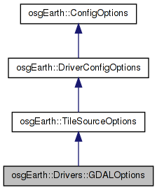
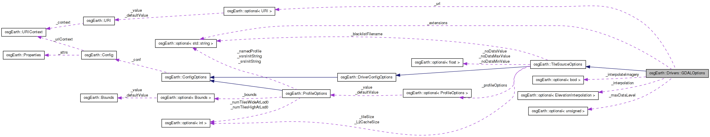
 Inheritance diagram for osgEarth::Drivers::GDALOptions: Collaboration diagram for osgEarth::Drivers::GDALOptions:
Public Member Functions | |
| optional< URI > & | url () |
| const optional< URI > & | url () const |
| optional< std::string > & | extensions () |
| const optional< std::string > & | extensions () const |
| optional < ElevationInterpolation > & | interpolation () |
| const optional < ElevationInterpolation > & | interpolation () const |
| optional< unsigned int > & | maxDataLevel () |
| const optional< unsigned int > & | maxDataLevel () const |
| optional< bool > & | interpolateImagery () |
| const optional< bool > & | interpolateImagery () const |
| GDALOptions (const TileSourceOptions &options=TileSourceOptions()) | |
Protected Member Functions | |
| Config | getConfig () const |
| void | mergeConfig (const Config &conf) |
| void | fromConfig (const Config &conf) |
Protected Attributes | |
| optional< URI > | _url |
| optional< std::string > | _extensions |
| optional< ElevationInterpolation > | _interpolation |
| optional< bool > | _interpolateImagery |
| optional< unsigned > | _maxDataLevel |
Definition at line 30 of file GDALOptions.
| osgEarth::Drivers::GDALOptions::GDALOptions | ( | const TileSourceOptions & | options = TileSourceOptions() | ) | [inline] |
Definition at line 51 of file GDALOptions.
                                                                             :
            TileSourceOptions( options ),
            _interpolation( INTERP_AVERAGE ),
            _interpolateImagery( false )
        {
            setDriver( "gdal" );
            fromConfig( _conf );
        }
| optional<std::string>& osgEarth::Drivers::GDALOptions::extensions | ( | ) | [inline] |
Definition at line 37 of file GDALOptions.
{ return _extensions; }
| const optional<std::string>& osgEarth::Drivers::GDALOptions::extensions | ( | ) | const [inline] |
Definition at line 38 of file GDALOptions.
{ return _extensions; }
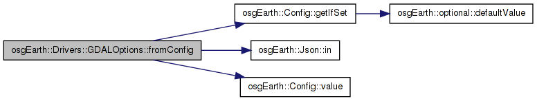
| void osgEarth::Drivers::GDALOptions::fromConfig | ( | const Config & | conf | ) | [inline, protected] |
Reimplemented from osgEarth::TileSourceOptions.
Definition at line 85 of file GDALOptions.
                                              {
            conf.getIfSet( "url", _url );
            conf.getIfSet( "extensions", _extensions );
            std::string in = conf.value( "interpolation" );
            if ( in == "nearest" ) _interpolation = osgEarth::INTERP_NEAREST;
            else if ( in == "average" ) _interpolation = osgEarth::INTERP_AVERAGE;
            else if ( in == "bilinear" ) _interpolation = osgEarth::INTERP_BILINEAR;
            conf.getIfSet( "max_data_level", _maxDataLevel);

            conf.getIfSet("interp_imagery", _interpolateImagery);
        }
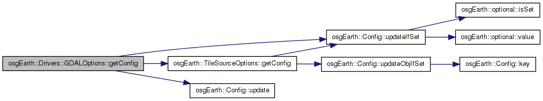
Here is the call graph for this function:| Config osgEarth::Drivers::GDALOptions::getConfig | ( | ) | const [inline, protected, virtual] |
Gets or sets the name of the object
Reimplemented from osgEarth::TileSourceOptions.
Definition at line 62 of file GDALOptions.
        {
            Config conf = TileSourceOptions::getConfig();
            conf.updateIfSet( "url", _url );
            conf.updateIfSet( "extensions", _extensions );

            if ( _interpolation.isSet() ) {
                if ( _interpolation.value() == osgEarth::INTERP_NEAREST ) conf.update( "interpolation", "nearest" );
                else if ( _interpolation.value() == osgEarth::INTERP_AVERAGE ) conf.update( "interpolation", "average" );
                else if ( _interpolation.value() == osgEarth::INTERP_BILINEAR ) conf.update( "interpolation", "bilinear" );
            }

            conf.updateIfSet( "max_data_level", _maxDataLevel);

            conf.updateIfSet( "interp_imagery", _interpolateImagery);
            return conf;
        }
Here is the call graph for this function:| optional<bool>& osgEarth::Drivers::GDALOptions::interpolateImagery | ( | ) | [inline] |
Definition at line 46 of file GDALOptions.
{ return _interpolateImagery;}
| const optional<bool>& osgEarth::Drivers::GDALOptions::interpolateImagery | ( | ) | const [inline] |
Definition at line 47 of file GDALOptions.
{ return _interpolateImagery;}
| optional<ElevationInterpolation>& osgEarth::Drivers::GDALOptions::interpolation | ( | ) | [inline] |
Definition at line 40 of file GDALOptions.
{ return _interpolation; }
| const optional<ElevationInterpolation>& osgEarth::Drivers::GDALOptions::interpolation | ( | ) | const [inline] |
Definition at line 41 of file GDALOptions.
{ return _interpolation; }
| const optional<unsigned int>& osgEarth::Drivers::GDALOptions::maxDataLevel | ( | ) | const [inline] |
Definition at line 44 of file GDALOptions.
{ return _maxDataLevel;}
| optional<unsigned int>& osgEarth::Drivers::GDALOptions::maxDataLevel | ( | ) | [inline] |
Definition at line 43 of file GDALOptions.
{ return _maxDataLevel;}
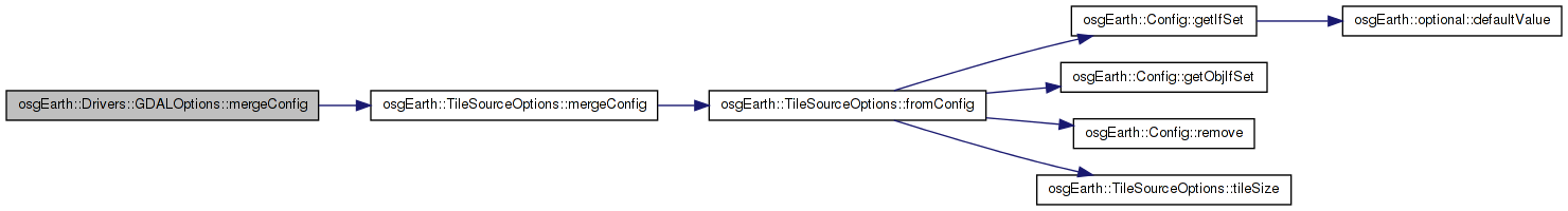
| void osgEarth::Drivers::GDALOptions::mergeConfig | ( | const Config & | conf | ) | [inline, protected, virtual] |
Reimplemented from osgEarth::TileSourceOptions.
Definition at line 80 of file GDALOptions.
                                               {
            TileSourceOptions::mergeConfig( conf );
            fromConfig( conf );
        }
Here is the call graph for this function:Definition at line 34 of file GDALOptions.
{ return _url; }
Here is the caller graph for this function:Definition at line 35 of file GDALOptions.
{ return _url; }
optional<std::string> osgEarth::Drivers::GDALOptions::_extensions [protected] |
Definition at line 98 of file GDALOptions.
optional<bool> osgEarth::Drivers::GDALOptions::_interpolateImagery [protected] |
Definition at line 100 of file GDALOptions.
optional<ElevationInterpolation> osgEarth::Drivers::GDALOptions::_interpolation [protected] |
Definition at line 99 of file GDALOptions.
optional<unsigned> osgEarth::Drivers::GDALOptions::_maxDataLevel [protected] |
Definition at line 101 of file GDALOptions.
optional<URI> osgEarth::Drivers::GDALOptions::_url [protected] |
Definition at line 97 of file GDALOptions.
 1.7.3
1.7.3