|
osgEarth 2.1.1
|
|
osgEarth 2.1.1
|
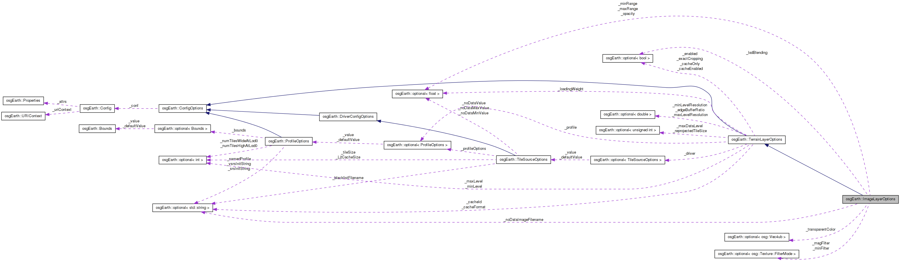
 Inheritance diagram for osgEarth::ImageLayerOptions: Collaboration diagram for osgEarth::ImageLayerOptions:
Public Member Functions | |
| ImageLayerOptions (const ConfigOptions &options=ConfigOptions()) | |
| ImageLayerOptions (const std::string &name, const TileSourceOptions &driverOpt=TileSourceOptions()) | |
| optional< float > & | opacity () |
| const optional< float > & | opacity () const |
| optional< float > & | minVisibleRange () |
| const optional< float > & | minVisibleRange () const |
| optional< float > & | maxVisibleRange () |
| const optional< float > & | maxVisibleRange () const |
| optional< std::string > & | noDataImageFilename () |
| const optional< std::string > & | noDataImageFilename () const |
| optional< osg::Vec4ub > & | transparentColor () |
| const optional< osg::Vec4ub > & | transparentColor () const |
| optional < osg::Texture::FilterMode > & | magFilter (void) |
| const optional < osg::Texture::FilterMode > & | magFilter (void) const |
| optional < osg::Texture::FilterMode > & | minFilter (void) |
| const optional < osg::Texture::FilterMode > & | minFilter (void) const |
| optional< bool > & | lodBlending () |
| const optional< bool > & | lodBlending () const |
| virtual Config | getConfig () const |
| virtual void | mergeConfig (const Config &conf) |
Private Member Functions | |
| void | fromConfig (const Config &conf) |
| void | setDefaults () |
Private Attributes | |
| optional< float > | _opacity |
| optional< float > | _minRange |
| optional< float > | _maxRange |
| optional< osg::Vec4ub > | _transparentColor |
| optional< std::string > | _noDataImageFilename |
| optional < osg::Texture::FilterMode > | _magFilter |
| optional < osg::Texture::FilterMode > | _minFilter |
| optional< bool > | _lodBlending |
Initialization options for an image layer.
Definition at line 36 of file ImageLayer.
| ImageLayerOptions::ImageLayerOptions | ( | const ConfigOptions & | options = ConfigOptions() | ) |
Constructs new image layer options.
Definition at line 36 of file ImageLayer.cpp.
                                                                   :
TerrainLayerOptions(options)
{
    setDefaults();
    fromConfig( _conf );
}
Here is the call graph for this function:| ImageLayerOptions::ImageLayerOptions | ( | const std::string & | name, |
| const TileSourceOptions & | driverOpt = TileSourceOptions() |
||
| ) |
Constructs new image layer options, giving a name to the layer and specifying driver options to use.
Definition at line 43 of file ImageLayer.cpp.
                                                                                                :
TerrainLayerOptions(name, driverOpt)
{
    setDefaults();
    fromConfig( _conf );
}
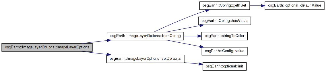
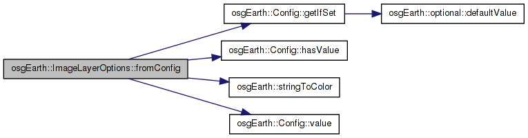
Here is the call graph for this function:| void ImageLayerOptions::fromConfig | ( | const Config & | conf | ) | [private] |
Reimplemented from osgEarth::TerrainLayerOptions.
Definition at line 68 of file ImageLayer.cpp.
{
    conf.getIfSet( "nodata_image", _noDataImageFilename );
    conf.getIfSet( "opacity", _opacity );
    conf.getIfSet( "min_range", _minRange );
    conf.getIfSet( "max_range", _maxRange );
    conf.getIfSet( "lod_blending", _lodBlending );

    if ( conf.hasValue( "transparent_color" ) )
        _transparentColor = stringToColor( conf.value( "transparent_color" ), osg::Vec4ub(0,0,0,0));

        //Load the filter settings
        conf.getIfSet("mag_filter","LINEAR",                _magFilter,osg::Texture::LINEAR);
    conf.getIfSet("mag_filter","LINEAR_MIPMAP_LINEAR",  _magFilter,osg::Texture::LINEAR_MIPMAP_LINEAR);
    conf.getIfSet("mag_filter","LINEAR_MIPMAP_NEAREST", _magFilter,osg::Texture::LINEAR_MIPMAP_NEAREST);
    conf.getIfSet("mag_filter","NEAREST",               _magFilter,osg::Texture::NEAREST);
    conf.getIfSet("mag_filter","NEAREST_MIPMAP_LINEAR", _magFilter,osg::Texture::NEAREST_MIPMAP_LINEAR);
    conf.getIfSet("mag_filter","NEAREST_MIPMAP_NEAREST",_magFilter,osg::Texture::NEAREST_MIPMAP_NEAREST);
    conf.getIfSet("min_filter","LINEAR",                _minFilter,osg::Texture::LINEAR);
    conf.getIfSet("min_filter","LINEAR_MIPMAP_LINEAR",  _minFilter,osg::Texture::LINEAR_MIPMAP_LINEAR);
    conf.getIfSet("min_filter","LINEAR_MIPMAP_NEAREST", _minFilter,osg::Texture::LINEAR_MIPMAP_NEAREST);
    conf.getIfSet("min_filter","NEAREST",               _minFilter,osg::Texture::NEAREST);
    conf.getIfSet("min_filter","NEAREST_MIPMAP_LINEAR", _minFilter,osg::Texture::NEAREST_MIPMAP_LINEAR);
    conf.getIfSet("min_filter","NEAREST_MIPMAP_NEAREST",_minFilter,osg::Texture::NEAREST_MIPMAP_NEAREST);
}
Here is the call graph for this function: Here is the caller graph for this function:| Config ImageLayerOptions::getConfig | ( | ) | const [virtual] |
Reimplemented from osgEarth::TerrainLayerOptions.
Definition at line 95 of file ImageLayer.cpp.
{
    Config conf = TerrainLayerOptions::getConfig();
    conf.updateIfSet( "nodata_image", _noDataImageFilename );
    conf.updateIfSet( "opacity", _opacity );
    conf.updateIfSet( "min_range", _minRange );
    conf.updateIfSet( "max_range", _maxRange );
    conf.updateIfSet( "lod_blending", _lodBlending );

        if (_transparentColor.isSet())
        conf.update("transparent_color", colorToString( _transparentColor.value()));

    //Save the filter settings
        conf.updateIfSet("mag_filter","LINEAR",                _magFilter,osg::Texture::LINEAR);
    conf.updateIfSet("mag_filter","LINEAR_MIPMAP_LINEAR",  _magFilter,osg::Texture::LINEAR_MIPMAP_LINEAR);
    conf.updateIfSet("mag_filter","LINEAR_MIPMAP_NEAREST", _magFilter,osg::Texture::LINEAR_MIPMAP_NEAREST);
    conf.updateIfSet("mag_filter","NEAREST",               _magFilter,osg::Texture::NEAREST);
    conf.updateIfSet("mag_filter","NEAREST_MIPMAP_LINEAR", _magFilter,osg::Texture::NEAREST_MIPMAP_LINEAR);
    conf.updateIfSet("mag_filter","NEAREST_MIPMAP_NEAREST",_magFilter,osg::Texture::NEAREST_MIPMAP_NEAREST);
    conf.updateIfSet("min_filter","LINEAR",                _minFilter,osg::Texture::LINEAR);
    conf.updateIfSet("min_filter","LINEAR_MIPMAP_LINEAR",  _minFilter,osg::Texture::LINEAR_MIPMAP_LINEAR);
    conf.updateIfSet("min_filter","LINEAR_MIPMAP_NEAREST", _minFilter,osg::Texture::LINEAR_MIPMAP_NEAREST);
    conf.updateIfSet("min_filter","NEAREST",               _minFilter,osg::Texture::NEAREST);
    conf.updateIfSet("min_filter","NEAREST_MIPMAP_LINEAR", _minFilter,osg::Texture::NEAREST_MIPMAP_LINEAR);
    conf.updateIfSet("min_filter","NEAREST_MIPMAP_NEAREST",_minFilter,osg::Texture::NEAREST_MIPMAP_NEAREST);

    return conf;
}
Here is the call graph for this function: Here is the caller graph for this function:| optional<bool>& osgEarth::ImageLayerOptions::lodBlending | ( | ) | [inline] |
Whether LOD blending is enabled for this layer
Definition at line 96 of file ImageLayer.
{ return _lodBlending; }
Here is the caller graph for this function:| const optional<bool>& osgEarth::ImageLayerOptions::lodBlending | ( | ) | const [inline] |
Definition at line 97 of file ImageLayer.
{ return _lodBlending; }
| optional<osg::Texture::FilterMode>& osgEarth::ImageLayerOptions::magFilter | ( | void | ) | [inline] |
The texture magnification mipmapping filter mode
Definition at line 84 of file ImageLayer.
{return _magFilter;}
| const optional<osg::Texture::FilterMode>& osgEarth::ImageLayerOptions::magFilter | ( | void | ) | const [inline] |
Definition at line 85 of file ImageLayer.
{return _magFilter;}
| optional<float>& osgEarth::ImageLayerOptions::maxVisibleRange | ( | ) | [inline] |
The initial maximum camera range at which this layer is visible.
Definition at line 66 of file ImageLayer.
{ return _maxRange; }
Here is the caller graph for this function:| const optional<float>& osgEarth::ImageLayerOptions::maxVisibleRange | ( | ) | const [inline] |
Definition at line 67 of file ImageLayer.
{ return _maxRange; }
| void ImageLayerOptions::mergeConfig | ( | const Config & | conf | ) | [virtual] |
Reimplemented from osgEarth::TerrainLayerOptions.
Definition at line 61 of file ImageLayer.cpp.
{
    TerrainLayerOptions::mergeConfig( conf );
    fromConfig( conf );
}
Here is the call graph for this function:| optional<osg::Texture::FilterMode>& osgEarth::ImageLayerOptions::minFilter | ( | void | ) | [inline] |
The texture minification mipmapping filter mode
Definition at line 90 of file ImageLayer.
{return _minFilter;}
| const optional<osg::Texture::FilterMode>& osgEarth::ImageLayerOptions::minFilter | ( | void | ) | const [inline] |
Definition at line 91 of file ImageLayer.
{return _minFilter;}
| optional<float>& osgEarth::ImageLayerOptions::minVisibleRange | ( | ) | [inline] |
The initial minimum camera range at which this layer is visible.
Definition at line 60 of file ImageLayer.
{ return _minRange; }
Here is the caller graph for this function:| const optional<float>& osgEarth::ImageLayerOptions::minVisibleRange | ( | ) | const [inline] |
Definition at line 61 of file ImageLayer.
{ return _minRange; }
| const optional<std::string>& osgEarth::ImageLayerOptions::noDataImageFilename | ( | ) | const [inline] |
Definition at line 73 of file ImageLayer.
{ return _noDataImageFilename; }
| optional<std::string>& osgEarth::ImageLayerOptions::noDataImageFilename | ( | ) | [inline] |
Gets or sets the nodata image for this MapLayer
Definition at line 72 of file ImageLayer.
{ return _noDataImageFilename; }
Here is the caller graph for this function:| const optional<float>& osgEarth::ImageLayerOptions::opacity | ( | ) | const [inline] |
Definition at line 55 of file ImageLayer.
{ return _opacity; }
| optional<float>& osgEarth::ImageLayerOptions::opacity | ( | ) | [inline] |
The initial opacity of this layer
Definition at line 54 of file ImageLayer.
{ return _opacity; }
Here is the caller graph for this function:| void ImageLayerOptions::setDefaults | ( | ) | [private] |
Reimplemented from osgEarth::TerrainLayerOptions.
Definition at line 51 of file ImageLayer.cpp.
{
    _opacity.init( 1.0f );
    _transparentColor.init( osg::Vec4ub(0,0,0,0) );
    _minRange.init( -FLT_MAX );
    _maxRange.init( FLT_MAX );
    _lodBlending.init( false );
}
Here is the call graph for this function: Here is the caller graph for this function:| const optional<osg::Vec4ub>& osgEarth::ImageLayerOptions::transparentColor | ( | ) | const [inline] |
Definition at line 79 of file ImageLayer.
{ return _transparentColor; }
| optional<osg::Vec4ub>& osgEarth::ImageLayerOptions::transparentColor | ( | ) | [inline] |
Gets the transparent color of this TileSource
Definition at line 78 of file ImageLayer.
{ return _transparentColor; }
Here is the caller graph for this function:optional<bool> osgEarth::ImageLayerOptions::_lodBlending [private] |
Definition at line 114 of file ImageLayer.
optional<osg::Texture::FilterMode> osgEarth::ImageLayerOptions::_magFilter [private] |
Definition at line 112 of file ImageLayer.
optional<float> osgEarth::ImageLayerOptions::_maxRange [private] |
Definition at line 109 of file ImageLayer.
optional<osg::Texture::FilterMode> osgEarth::ImageLayerOptions::_minFilter [private] |
Definition at line 113 of file ImageLayer.
optional<float> osgEarth::ImageLayerOptions::_minRange [private] |
Definition at line 108 of file ImageLayer.
optional<std::string> osgEarth::ImageLayerOptions::_noDataImageFilename [private] |
Definition at line 111 of file ImageLayer.
optional<float> osgEarth::ImageLayerOptions::_opacity [private] |
Definition at line 107 of file ImageLayer.
optional<osg::Vec4ub> osgEarth::ImageLayerOptions::_transparentColor [private] |
Definition at line 110 of file ImageLayer.
 1.7.3
1.7.3