|
osgEarth 2.1.1
|
|
osgEarth 2.1.1
|
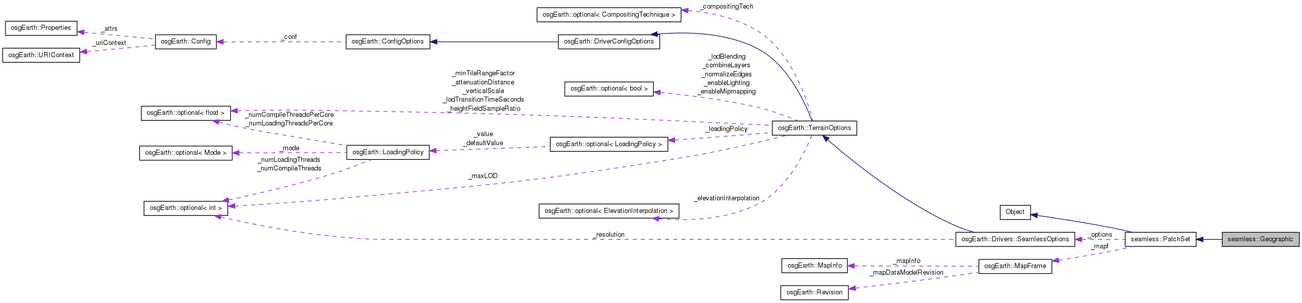
 Inheritance diagram for seamless::Geographic: Collaboration diagram for seamless::Geographic:
Public Member Functions | |
| Geographic (const osgEarth::Map *map, const osgEarth::Drivers::SeamlessOptions &options) | |
| Geographic (const Geographic &rhs, const osg::CopyOp ©op=osg::CopyOp::SHALLOW_COPY) | |
| META_Object (seamless, PatchSet) | |
| virtual | ~Geographic () |
| virtual osg::Node * | createPatchGroup (const std::string &filename, PatchOptions *poptions) |
| virtual osg::Transform * | createPatch (const std::string &filename, PatchOptions *poptions) |
| virtual osg::Node * | createPatchSetGraph (const std::string &filename) |
| virtual osg::Node * | createChild (const PatchOptions *parentOptions, int childNum) |
| osgEarth::Profile * | getProfile () const |
| void | setEllipsoidModel (osg::EllipsoidModel *eModel) |
| osg::EllipsoidModel * | getEllipsoidModel () const |
| osg::Vec3d | toModel (double cubeX, double cubeY, double elevation) |
| osgEarth::TaskService * | getHeightFieldService () |
| osgEarth::TaskService * | getImageService () |
Protected Attributes | |
| osg::ref_ptr< EulerProfile > | _profile |
| osg::ref_ptr< osg::EllipsoidModel > | _eModel |
| osg::ref_ptr < osgEarth::TaskService > | _hfService |
| osg::ref_ptr < osgEarth::TaskService > | _imageService |
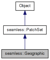
Definition at line 39 of file Geographic.
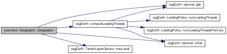
| seamless::Geographic::Geographic | ( | const osgEarth::Map * | map, |
| const osgEarth::Drivers::SeamlessOptions & | options | ||
| ) |
Definition at line 34 of file Geographic.cpp.
{
    setPrecisionFactor(8);
    setMap(map);
    {
        int maxLevel = 0;
        const ElevationLayerVector& elevations = _mapf->elevationLayers();
        for (ElevationLayerVector::const_iterator itr = elevations.begin(),
                 end = elevations.end();
             itr != end;
             ++itr)
        {
            const TerrainLayerOptions& options
                = (*itr)->getTerrainLayerOptions();
            if (options.maxLevel().isSet()
                && options.maxLevel().get() > maxLevel)
                maxLevel = options.maxLevel().get();
        }
        if (maxLevel > 0)
            setMaxLevel(maxLevel);

    }
    int serviceThreads = computeLoadingThreads(_options.loadingPolicy().get());
    _hfService = new TaskService("Height Field Service", serviceThreads);
    _imageService = new TaskService("Image Service", serviceThreads);
}

Geographic::Geographic(const Geographic& rhs, const osg::CopyOp& copyop)
    : PatchSet(rhs, copyop),
Here is the call graph for this function:| seamless::Geographic::Geographic | ( | const Geographic & | rhs, |
| const osg::CopyOp & | copyop = osg::CopyOp::SHALLOW_COPY |
||
| ) |
Definition at line 64 of file Geographic.cpp.
{
}

Geographic::~Geographic()
{
| seamless::Geographic::~Geographic | ( | ) | [virtual] |
Definition at line 72 of file Geographic.cpp.
{
| Node * seamless::Geographic::createChild | ( | const PatchOptions * | parentOptions, |
| int | childNum | ||
| ) | [virtual] |
| Transform * seamless::Geographic::createPatch | ( | const std::string & | filename, |
| PatchOptions * | poptions | ||
| ) | [virtual] |
| virtual osg::Node* seamless::Geographic::createPatchGroup | ( | const std::string & | filename, |
| PatchOptions * | poptions | ||
| ) | [virtual] |
Reimplemented from seamless::PatchSet.
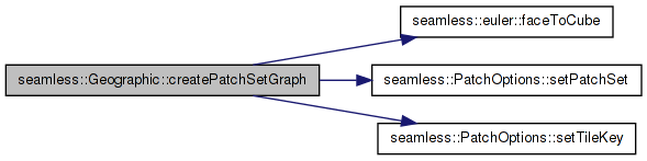
| Node * seamless::Geographic::createPatchSetGraph | ( | const std::string & | filename | ) | [virtual] |
Reimplemented from seamless::PatchSet.
Definition at line 76 of file Geographic.cpp.
                                  :4326");
    csn->setFormat("WKT");
    csn->setEllipsoidModel(_eModel.get());
    for (int face = 0; face < 6; ++face)
    {
        double x = 0.0, y = 0.0;
        euler::faceToCube(x, y, face);
        PatchOptions* poptions = static_cast<PatchOptions*>(
            osg::clone(getPatchOptionsPrototype()));
        poptions->setPatchSet(this);
        poptions->setTileKey(_profile->createTileKey(x, y, 2));
        Node* node = createPatchGroup("foobar.osgearth_engine_seamless_patch",
                                      poptions);
        csn->addChild(node);
    }
    return csn;
}

namespace
{
Here is the call graph for this function:| osg::EllipsoidModel* seamless::Geographic::getEllipsoidModel | ( | ) | const [inline] |
Definition at line 56 of file Geographic.
| osgEarth::TaskService* seamless::Geographic::getHeightFieldService | ( | ) | [inline] |
Definition at line 59 of file Geographic.
{ return _imageService; }
| osgEarth::TaskService* seamless::Geographic::getImageService | ( | ) | [inline] |
Definition at line 60 of file Geographic.
:
    osg::ref_ptr<EulerProfile> _profile;
| osgEarth::Profile* seamless::Geographic::getProfile | ( | ) | const [inline] |
Definition at line 54 of file Geographic.
{ _eModel = eModel; }
| seamless::Geographic::META_Object | ( | seamless | , |
| PatchSet | |||
| ) |
Reimplemented from seamless::PatchSet.
| void seamless::Geographic::setEllipsoidModel | ( | osg::EllipsoidModel * | eModel | ) | [inline] |
Definition at line 55 of file Geographic.
{ return _eModel.get(); }
| Vec3d seamless::Geographic::toModel | ( | double | cubeX, |
| double | cubeY, | ||
| double | elevation | ||
| ) |
Definition at line 548 of file Geographic.cpp.
{
osg::ref_ptr<osg::EllipsoidModel> seamless::Geographic::_eModel [protected] |
Definition at line 63 of file Geographic.
osg::ref_ptr<osgEarth::TaskService> seamless::Geographic::_hfService [protected] |
Definition at line 64 of file Geographic.
osg::ref_ptr<osgEarth::TaskService> seamless::Geographic::_imageService [protected] |
Definition at line 65 of file Geographic.
osg::ref_ptr<EulerProfile> seamless::Geographic::_profile [protected] |
Definition at line 62 of file Geographic.
 1.7.3
1.7.3