|
osgEarth 2.1.1
|
|
osgEarth 2.1.1
|
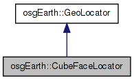
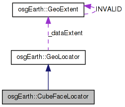
 Inheritance diagram for osgEarth::CubeFaceLocator: Collaboration diagram for osgEarth::CubeFaceLocator:
Public Member Functions | |
| CubeFaceLocator (unsigned int face) | |
| bool | convertLocalToModel (const osg::Vec3d &local, osg::Vec3d &world) const |
| bool | convertModelToLocal (const osg::Vec3d &world, osg::Vec3d &local) const |
Private Attributes | |
| unsigned int | _face |
osgTerrain locator for positioning data on the terrain using a cube-face coordinate system.
| CubeFaceLocator::CubeFaceLocator | ( | unsigned int | face | ) |
| bool CubeFaceLocator::convertLocalToModel | ( | const osg::Vec3d & | local, |
| osg::Vec3d & | world | ||
| ) | const |
Definition at line 304 of file Cube.cpp.
{
#if ((OPENSCENEGRAPH_MAJOR_VERSION <= 2) && (OPENSCENEGRAPH_MINOR_VERSION < 8))
    // OSG 2.7 bug workaround: bug fix in Locator submitted by GW
    const_cast<CubeFaceLocator*>(this)->_inverse.invert( _transform );
#endif

    if ( _coordinateSystemType == GEOCENTRIC )
    {
        //Convert the NDC coordinate into face space
        osg::Vec3d faceCoord = local * _transform;

        double lat_deg, lon_deg;
        CubeUtils::faceCoordsToLatLon( faceCoord.x(), faceCoord.y(), _face, lat_deg, lon_deg );

        //OE_NOTICE << "LatLon=" << latLon <<  std::endl;

        // convert to geocentric:
        _ellipsoidModel->convertLatLongHeightToXYZ(
            osg::DegreesToRadians( lat_deg ),
            osg::DegreesToRadians( lon_deg ),
            local.z(),
            world.x(), world.y(), world.z() );

        return true;
    }
    return true;
}
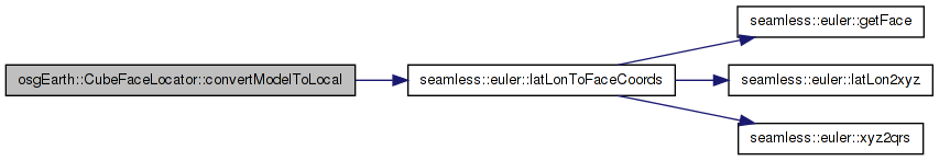
Here is the call graph for this function:| bool CubeFaceLocator::convertModelToLocal | ( | const osg::Vec3d & | world, |
| osg::Vec3d & | local | ||
| ) | const [virtual] |
Reimplemented from osgEarth::GeoLocator.
Definition at line 335 of file Cube.cpp.
{
#if ((OPENSCENEGRAPH_MAJOR_VERSION <= 2) && (OPENSCENEGRAPH_MINOR_VERSION < 8))
    // OSG 2.7 bug workaround: bug fix in Locator submitted by GW
    const_cast<CubeFaceLocator*>(this)->_inverse.invert( _transform );
#endif

    switch(_coordinateSystemType)
    {
    case(GEOCENTRIC):
        {
            double longitude, latitude, height;

            _ellipsoidModel->convertXYZToLatLongHeight(world.x(), world.y(), world.z(), latitude, longitude, height );

            int face=-1;
            double x, y;

            double lat_deg = osg::RadiansToDegrees(latitude);
            double lon_deg = osg::RadiansToDegrees(longitude);

            bool success = CubeUtils::latLonToFaceCoords( lat_deg, lon_deg, x, y, face, _face );

            if (!success)
            {
                OE_NOTICE << LC << "Couldn't convert to face coords " << std::endl;
            }
            if (face != _face)
            {
                OE_NOTICE << LC
                    << "Face should be " << _face << " but is " << face
                    << ", lat = " << lat_deg
                    << ", lon = " << lon_deg
                    << std::endl;
            }

            local = osg::Vec3d( x, y, height ) * _inverse;
            return true;
        }


    case(GEOGRAPHIC):
    case(PROJECTED):
        // Neither of these is supported for this locator..
        {
            local = world * _inverse;
            return true;
        }
    }

    return false;
}
Here is the call graph for this function:unsigned int osgEarth::CubeFaceLocator::_face [private] |
 1.7.3
1.7.3