|
osgEarth 2.1.1
|
|
osgEarth 2.1.1
|
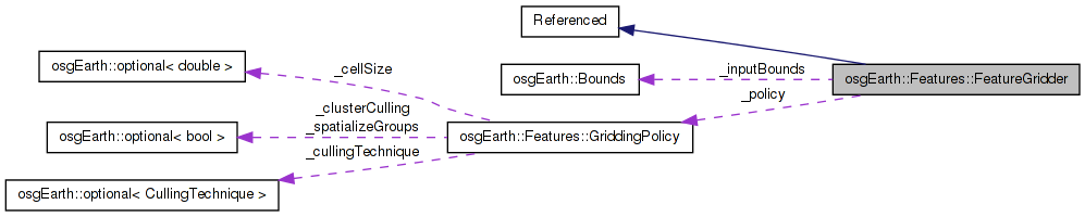
 Inheritance diagram for osgEarth::Features::FeatureGridder: Collaboration diagram for osgEarth::Features::FeatureGridder:
Public Member Functions | |
| FeatureGridder (const Bounds &bounds, const GriddingPolicy &policy) | |
| int | getNumCells () const |
| bool | getCellBounds (int i, Bounds &output) const |
| bool | cullFeatureListToCell (int i, FeatureList &features) const |
| virtual | ~FeatureGridder () |
Static Public Member Functions | |
| static bool | isSupported () |
Protected Attributes | |
| Bounds | _inputBounds |
| GriddingPolicy | _policy |
| int | _cellsX |
| int | _cellsY |
| std::list< void * > | _geosGeoms |
Given a list of features, this will grid them up and return one grid cell at a time. For each grid cell, it will crop the feature geometry to the cell boundary.
Definition at line 88 of file FeatureGridder.
| FeatureGridder::FeatureGridder | ( | const Bounds & | bounds, |
| const GriddingPolicy & | policy | ||
| ) |
Definition at line 87 of file FeatureGridder.cpp.
                                                              :
_inputBounds( inputBounds ),
_policy( policy )
{
    if ( _policy.enabled() ) //_policy.cellSize().isSet() && *_policy.cellSize() > 0.0 )
    {
        _cellsX = (int)::ceil(_inputBounds.width() / *_policy.cellSize() );
        _cellsY = (int)::ceil(_inputBounds.height() / *_policy.cellSize() );
    }
    else
    {
        _cellsX = 1;
        _cellsY = 1;
    }

    _cellsX = osg::clampAbove( _cellsX, 1 );
    _cellsY = osg::clampAbove( _cellsY, 1 );

#ifndef OSGEARTH_HAVE_GEOS

    if ( _policy.cullingTechnique().isSetTo( GriddingPolicy::CULL_BY_CROPPING ) )
    {
        OE_WARN
            << "Warning: Gridding policy 'cull by cropping' requires GEOS. Falling back on 'cull by centroid'."
            << std::endl;

        _policy.cullingTechnique() = GriddingPolicy::CULL_BY_CENTROID;
    }

#endif // !OSGEARTH_HAVE_GEOS
}
Here is the call graph for this function:| FeatureGridder::~FeatureGridder | ( | ) | [virtual] |
Definition at line 120 of file FeatureGridder.cpp.
{
    //nop
}
| bool FeatureGridder::cullFeatureListToCell | ( | int | i, |
| FeatureList & | features | ||
| ) | const |
Definition at line 151 of file FeatureGridder.cpp.
{
    bool success = true;
    int inCount = features.size();

    Bounds b;
    if ( getCellBounds( i, b ) )
    {
        if ( _policy.cullingTechnique() == GriddingPolicy::CULL_BY_CENTROID )
        {
            for( FeatureList::iterator f_i = features.begin(); f_i != features.end();  )
            {
                bool keepFeature = false;

                Feature* feature = f_i->get();
                Symbology::Geometry* featureGeom = feature->getGeometry();
                if ( featureGeom )
                {
                    osg::Vec3d centroid = featureGeom->getBounds().center();
                    if ( b.contains( centroid.x(), centroid.y() ) )
                    {
                        keepFeature = true;
                    }
                }

                if ( keepFeature )
                    ++f_i;
                else
                    f_i = features.erase( f_i );
            }
        }

        else // CULL_BY_CROPPING (requires GEOS)
        {

#ifdef OSGEARTH_HAVE_GEOS

            // create the intersection polygon:
            osg::ref_ptr<Symbology::Polygon> poly = new Symbology::Polygon( 4 );
            poly->push_back( osg::Vec3d( b.xMin(), b.yMin(), 0 ));
            poly->push_back( osg::Vec3d( b.xMax(), b.yMin(), 0 ));
            poly->push_back( osg::Vec3d( b.xMax(), b.yMax(), 0 ));
            poly->push_back( osg::Vec3d( b.xMin(), b.yMax(), 0 ));

            for( FeatureList::iterator f_i = features.begin(); f_i != features.end();  )
            {
                bool keepFeature = false;

                Feature* feature = f_i->get();
                Symbology::Geometry* featureGeom = feature->getGeometry();
                if ( featureGeom )
                {
                    osg::ref_ptr<Symbology::Geometry> croppedGeometry;
                    if ( featureGeom->crop( poly.get(), croppedGeometry ) )
                    {
                        feature->setGeometry( croppedGeometry.get() );
                        keepFeature = true;
                    }
                }

                if ( keepFeature )
                    ++f_i;
                else
                    f_i = features.erase( f_i );
            }

#endif // OSGEARTH_HAVE_GEOS

        }

    }

    OE_INFO << LC
            << "Grid cell " << i << ": bounds="
            << b.xMin() << "," << b.yMin() << " => " << b.xMax() << "," << b.yMax()
            << "; in=" << inCount << "; out=" << features.size()
            << std::endl;

    return success;
}
Here is the call graph for this function:| bool FeatureGridder::getCellBounds | ( | int | i, |
| Bounds & | output | ||
| ) | const |
Definition at line 132 of file FeatureGridder.cpp.
{
    if ( i >= 0 && i < (_cellsX*_cellsY) )
    {
        int x = i % _cellsX;
        int y = i / _cellsX;

        double xmin = _inputBounds.xMin() + _policy.cellSize().value()  * (double)x;
        double ymin = _inputBounds.yMin() + _policy.cellSize().value() * (double)y;
        double xmax = osg::clampBelow( _inputBounds.xMin() + *_policy.cellSize() * (double)(x+1), _inputBounds.xMax() );
        double ymax = osg::clampBelow( _inputBounds.yMin() + *_policy.cellSize() * (double)(y+1), _inputBounds.yMax() );

        output = Bounds( xmin, ymin, xmax, ymax );
        return true;
    }
    return false;
}
Here is the call graph for this function: Here is the caller graph for this function:| int FeatureGridder::getNumCells | ( | ) | const |
Definition at line 126 of file FeatureGridder.cpp.
| static bool osgEarth::Features::FeatureGridder::isSupported | ( | ) | [static] |
int osgEarth::Features::FeatureGridder::_cellsX [protected] |
Definition at line 108 of file FeatureGridder.
int osgEarth::Features::FeatureGridder::_cellsY [protected] |
Definition at line 108 of file FeatureGridder.
std::list<void*> osgEarth::Features::FeatureGridder::_geosGeoms [protected] |
Definition at line 109 of file FeatureGridder.
Definition at line 106 of file FeatureGridder.
Definition at line 107 of file FeatureGridder.
 1.7.3
1.7.3