|
osgEarth 2.1.1
|
|
osgEarth 2.1.1
|
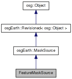
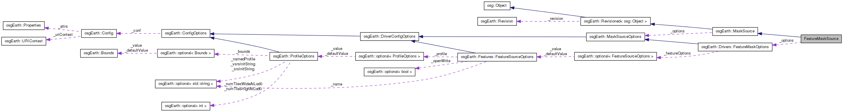
 Inheritance diagram for FeatureMaskSource: Collaboration diagram for FeatureMaskSource:
Public Member Functions | |
| FeatureMaskSource (const MaskSourceOptions &options) | |
| const MaskSourceOptions & | getOptions () const |
| void | initialize (const std::string &referenceURI, const osgEarth::Map *map) |
| osg::Vec3dArray * | createBoundary (const SpatialReference *srs, ProgressCallback *progress) |
Private Attributes | |
| bool | _failed |
| const FeatureMaskOptions | _options |
| osg::ref_ptr< FeatureSource > | _features |
Definition at line 40 of file FeatureMaskSource.cpp.
| FeatureMaskSource::FeatureMaskSource | ( | const MaskSourceOptions & | options | ) | [inline] |
Definition at line 43 of file FeatureMaskSource.cpp.
        : MaskSource( options ), _options( options ), _failed( false )
    {
        // the data source from which to pull features:
        if ( _options.featureSource().valid() )
        {
            _features = _options.featureSource().get();
        }
        else if ( _options.featureOptions().isSet() )
        {
            _features = FeatureSourceFactory::create( _options.featureOptions().value() );
            if ( !_features.valid() )
            {
                OE_WARN << "FeatureModelSource - no valid feature source provided" << std::endl;
            }
        }
    }
| osg::Vec3dArray* FeatureMaskSource::createBoundary | ( | const SpatialReference * | srs, |
| ProgressCallback * | progress | ||
| ) | [inline, virtual] |
Subclass implements this method to create the boundary geometry.
Implements osgEarth::MaskSource.
Definition at line 78 of file FeatureMaskSource.cpp.
    {
        if ( _failed )
            return 0L;

        if ( _features.valid() )
        {
            if ( _features->getFeatureProfile() )
            {
                osg::ref_ptr<FeatureCursor> cursor = _features->createFeatureCursor();
                if ( cursor )
                {
                    if ( cursor->hasMore() )
                    {
                        Feature* f = cursor->nextFeature();
                        if ( f && f->getGeometry() )
                        {
                            // Init a filter to tranform feature in desired SRS
                            if (!srs->isEquivalentTo(_features->getFeatureProfile()->getSRS())) {
                                FilterContext cx;
                                cx.profile() = new FeatureProfile(_features->getFeatureProfile()->getExtent());
                                //cx.isGeocentric() = _features->getFeatureProfile()->getSRS()->isGeographic();

                                TransformFilter xform( srs );
                                FeatureList featureList;
                                featureList.push_back(f);
                                cx = xform.push(featureList, cx);
                            }

                            return f->getGeometry()->toVec3dArray();
                        }
                    }
                }
            }
            else
            {
                OE_WARN << LC << "Failed to create boundary; feature source has no SRS" << std::endl;
                _failed = true;
            }
        }
        else
        {
            OE_WARN << LC << "Unable to create boundary; invalid feature source" << std::endl;
            _failed = true;
        }
        return 0L;
    }
Here is the call graph for this function:| const MaskSourceOptions& FeatureMaskSource::getOptions | ( | ) | const [inline] |
Reimplemented from osgEarth::MaskSource.
Definition at line 61 of file FeatureMaskSource.cpp.
{ return _options; }
| void FeatureMaskSource::initialize | ( | const std::string & | referenceURI, |
| const osgEarth::Map * | map | ||
| ) | [inline, virtual] |
Reimplemented from osgEarth::MaskSource.
Definition at line 64 of file FeatureMaskSource.cpp.
    {
        MaskSource::initialize( referenceURI, map );

        if ( _features.valid() )
        {
            _features->initialize( referenceURI );
        }
        else
        {
            OE_WARN << LC << "No FeatureSource; nothing will be rendered (" << getName() << ")" << std::endl;
        }
    }
Here is the call graph for this function:bool FeatureMaskSource::_failed [private] |
Definition at line 127 of file FeatureMaskSource.cpp.
osg::ref_ptr<FeatureSource> FeatureMaskSource::_features [private] |
Definition at line 129 of file FeatureMaskSource.cpp.
const FeatureMaskOptions FeatureMaskSource::_options [private] |
Reimplemented from osgEarth::MaskSource.
Definition at line 128 of file FeatureMaskSource.cpp.
 1.7.3
1.7.3