|
osgEarth 2.1.1
|
|
osgEarth 2.1.1
|
#include <osg/Notify>#include <osg/Shape>#include <osg/ShapeDrawable>#include <osg/Geode>#include <osg/AutoTransform>#include <osg/MatrixTransform>#include <osgText/Text>#include <osgGA/StateSetManipulator>#include <osgGA/GUIEventHandler>#include <osgViewer/Viewer>#include <osgViewer/ViewerEventHandlers>#include <osgUtil/LineSegmentIntersector>#include <osgEarth/MapNode>#include <osgEarth/FindNode>#include <osgEarth/ElevationQuery>#include <osgEarthUtil/EarthManipulator>#include <osgEarthUtil/ObjectLocator>#include <osg/Depth>#include <sstream>#include <iomanip> Include dependency graph for osgearth_elevation.cpp:
Go to the source code of this file.
Classes | |
| struct | QueryElevationHandler |
Functions | |
| static osg::Node * | createFlag () |
| int | main (int argc, char **argv) |
Variables | |
| static osg::Node * | s_flagNode |
| static osgText::Text * | s_flagText |
| static osg::Node* createFlag | ( | ) | [static] |
Definition at line 48 of file osgearth_elevation.cpp.
{
    osg::Geode* g = new osg::Geode();
    osgText::Text* text = new osgText::Text();
    text->setCharacterSizeMode( osgText::Text::SCREEN_COORDS );
    text->setCharacterSize( 24.f );
    text->setFont( osgText::readFontFile("arial.ttf") );
    text->setBackdropType( osgText::Text::OUTLINE );
    text->setText( "00000000000000" );
    text->setAutoRotateToScreen( true );
    text->setPosition( osg::Vec3d( 0, 0, 0 ) );
    text->setDataVariance( osg::Object::DYNAMIC );
    g->addDrawable( text );
    g->getOrCreateStateSet()->setMode( GL_LIGHTING, 0 );
    g->getStateSet()->setAttribute( new osg::Depth(osg::Depth::ALWAYS), 1 );
    g->getStateSet()->setRenderBinDetails( 99, "RenderBin" );
    g->setDataVariance( osg::Object::DYNAMIC );
    g->setCullingActive( false );
    g->setNodeMask( 0 );
    s_flagText = text;
    s_flagNode = g;
    return g;
}
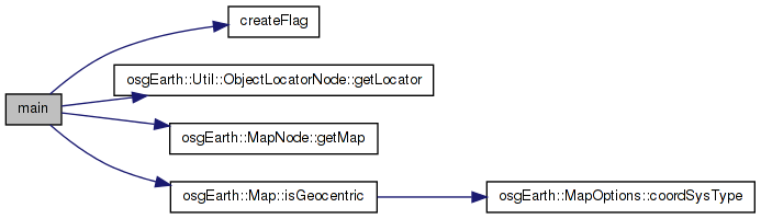
Here is the caller graph for this function:| int main | ( | int | argc, |
| char ** | argv | ||
| ) |
Definition at line 157 of file osgearth_elevation.cpp.
{
    osg::ArgumentParser arguments(&argc,argv);

    osgViewer::Viewer viewer(arguments);

        osgEarth::MapNode* mapNode = NULL;

        osg::Node* loadedNode = osgDB::readNodeFiles( arguments );
    if (loadedNode)
    {
                mapNode = findTopMostNodeOfType<osgEarth::MapNode>( loadedNode );
    }

    if ( !mapNode )
    {
        OE_WARN << "Unable to load earth file." << std::endl;
        return -1;
    }

    osg::Group* root = new osg::Group();

    // The MapNode will render the Map object in the scene graph.
    mapNode->setNodeMask( 0x01 );
    root->addChild( mapNode );

    // A flag so we can see where we clicked
    ObjectLocatorNode* flag = new ObjectLocatorNode( mapNode->getMap() );
    flag->addChild( createFlag() );
    flag->setNodeMask( 0x02 );
    root->addChild( flag );

    viewer.setSceneData( root );

    // An event handler that will respond to mouse clicks:
    viewer.addEventHandler( new QueryElevationHandler( mapNode->getMap(), flag->getLocator() ) );

    // add some stock OSG handlers:
    viewer.addEventHandler(new osgViewer::StatsHandler());
    viewer.addEventHandler(new osgViewer::WindowSizeHandler());
    viewer.addEventHandler(new osgGA::StateSetManipulator(viewer.getCamera()->getOrCreateStateSet()));

    // install the programmable manipulator.
    if ( mapNode->getMap()->isGeocentric() )
        viewer.setCameraManipulator( new osgEarth::Util::EarthManipulator() );

    return viewer.run();
}
Here is the call graph for this function:osg::Node* s_flagNode [static] |
Definition at line 44 of file osgearth_elevation.cpp.
osgText::Text* s_flagText [static] |
Definition at line 45 of file osgearth_elevation.cpp.
 1.7.3
1.7.3