|
osgEarth 2.1.1
|
|
osgEarth 2.1.1
|
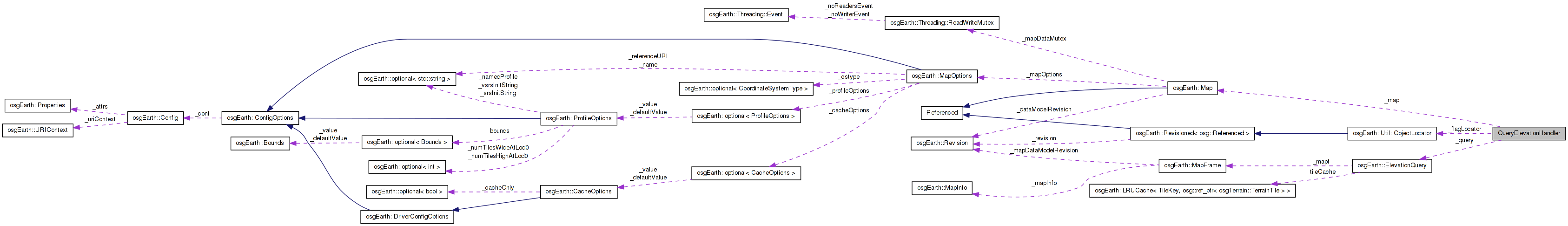
 Collaboration diagram for QueryElevationHandler:
Public Member Functions | |
| QueryElevationHandler (const Map *map, ObjectLocator *flagLocator) | |
| void | update (float x, float y, osgViewer::View *view) |
| bool | handle (const osgGA::GUIEventAdapter &ea, osgGA::GUIActionAdapter &aa) |
Public Attributes | |
| const Map * | _map |
| bool | _mouseDown |
| ElevationQuery | _query |
| ObjectLocator * | _flagLocator |
Definition at line 73 of file osgearth_elevation.cpp.
| QueryElevationHandler::QueryElevationHandler | ( | const Map * | map, |
| ObjectLocator * | flagLocator | ||
| ) | [inline] |
Definition at line 75 of file osgearth_elevation.cpp.
        : _map(map),
          _mouseDown( false ),
          _flagLocator(flagLocator),
          _query(map)
    {
        _query.setMaxTilesToCache(10);
    }
| bool QueryElevationHandler::handle | ( | const osgGA::GUIEventAdapter & | ea, |
| osgGA::GUIActionAdapter & | aa | ||
| ) | [inline] |
Definition at line 139 of file osgearth_elevation.cpp.
    {
        if ( ea.getEventType() == osgGA::GUIEventAdapter::MOVE )
        {
            osgViewer::View* view = static_cast<osgViewer::View*>(aa.asView());
            update( ea.getX(), ea.getY(), view );
        }

        return false;
    }
| void QueryElevationHandler::update | ( | float | x, |
| float | y, | ||
| osgViewer::View * | view | ||
| ) | [inline] |
Definition at line 84 of file osgearth_elevation.cpp.
    {
        osgUtil::LineSegmentIntersector::Intersections results;
        if ( view->computeIntersections( x, y, results, 0x01 ) )
        {
            // find the first hit under the mouse:
            osgUtil::LineSegmentIntersector::Intersection first = *(results.begin());
            osg::Vec3d point = first.getWorldIntersectPoint();
            osg::Vec3d lla;

            // transform it to map coordinates:
            _map->worldPointToMapPoint(point, lla);

            // find the elevation at that map point:
            osg::Matrixd out_mat;
            double query_resolution = 0.1; // 1/10th of a degree
            double out_elevation = 0.0;
            double out_resolution = 0.0;

            bool ok = _query.getElevation(
                lla,
                _map->getProfile()->getSRS(),
                out_elevation,
                query_resolution,
                &out_resolution );

            if ( ok )
            {
                _flagLocator->setPosition( osg::Vec3d(lla.x(), lla.y(), out_elevation) );
                s_flagNode->setNodeMask( ~0 );

                std::stringstream buf;
                buf << std::fixed << std::setprecision(2)
                    << "Pos: " << lla.x() << ", " << lla.y() << std::endl
                    << "Elv: " << out_elevation << "m" << std::endl
                    << "X:   " << point.x() << std::endl
                    << "Y:   " << point.y() << std::endl
                    << "Z:   " << point.z();
                s_flagText->setText( buf.str() );

                OE_NOTICE << buf.str() << std::endl;
            }
            else
            {
                OE_NOTICE
                    << "getElevation FAILED! at (" << point.x() << ", " << point.y() << ")" << std::endl;
            }

        }
        else
        {
            s_flagNode->setNodeMask(0);
        }
    }
Definition at line 153 of file osgearth_elevation.cpp.
| const Map* QueryElevationHandler::_map |
Definition at line 150 of file osgearth_elevation.cpp.
Definition at line 151 of file osgearth_elevation.cpp.
Definition at line 152 of file osgearth_elevation.cpp.
 1.7.3
1.7.3