|
osgEarth 2.1.1
|
|
osgEarth 2.1.1
|
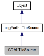
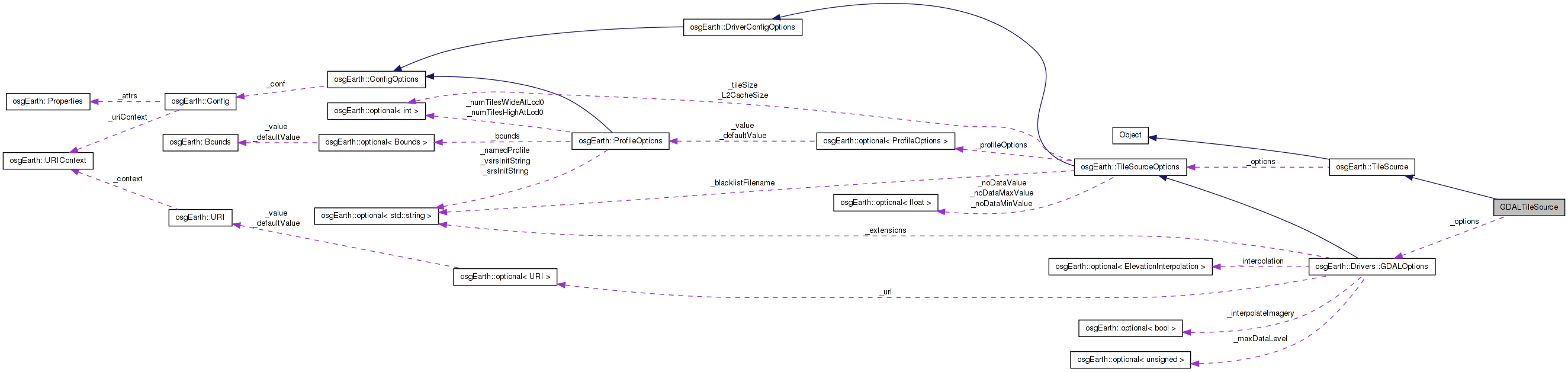
 Inheritance diagram for GDALTileSource: Collaboration diagram for GDALTileSource:
Public Member Functions | |
| GDALTileSource (const TileSourceOptions &options) | |
| virtual | ~GDALTileSource () |
| void | initialize (const std::string &referenceURI, const Profile *overrideProfile) |
| void | pixelToGeo (double x, double y, double &geoX, double &geoY) |
| osg::Image * | createImage (const TileKey &key, ProgressCallback *progress) |
| bool | isValidValue (float v, GDALRasterBand *band) |
| float | getInterpolatedValue (GDALRasterBand *band, double x, double y, bool applyOffset=true) |
| osg::HeightField * | createHeightField (const TileKey &key, ProgressCallback *progress) |
| bool | intersects (const TileKey &key) |
Static Public Member Functions | |
| static GDALRasterBand * | findBand (GDALDataset *ds, GDALColorInterp colorInterp) |
| static void | getPalleteIndexColor (GDALRasterBand *band, int index, osg::Vec4ub &color) |
Private Attributes | |
| GDALDataset * | _srcDS |
| GDALDataset * | _warpedDS |
| double | _geotransform [6] |
| double | _invtransform [6] |
| osg::Vec2d | _extentsMin |
| osg::Vec2d | _extentsMax |
| const GDALOptions | _options |
| unsigned int | _maxDataLevel |
Definition at line 611 of file ReaderWriterGDAL.cpp.
| GDALTileSource::GDALTileSource | ( | const TileSourceOptions & | options | ) | [inline] |
Definition at line 614 of file ReaderWriterGDAL.cpp.
                                                       :
      TileSource( options ),
      _srcDS(NULL),
      _warpedDS(NULL),
      _options(options),
      _maxDataLevel(30)
    {
    }
| virtual GDALTileSource::~GDALTileSource | ( | ) | [inline, virtual] |
Definition at line 623 of file ReaderWriterGDAL.cpp.
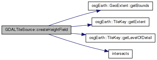
| osg::HeightField* GDALTileSource::createHeightField | ( | const TileKey & | key, |
| ProgressCallback * | progress | ||
| ) | [inline, virtual] |
Creates a heightfield for the given TileKey The returned object is new and is the responsibility of the caller.
Reimplemented from osgEarth::TileSource.
Definition at line 1459 of file ReaderWriterGDAL.cpp.
    {
        if (key.getLevelOfDetail() > _maxDataLevel)
        {
            //OE_NOTICE << "Reached maximum data resolution key=" << key.getLevelOfDetail() << " max=" << _maxDataLevel <<  std::endl;
            return NULL;
        }

        GDAL_SCOPED_LOCK;

        int tileSize = _options.tileSize().value();

        //Allocate the heightfield
        osg::ref_ptr<osg::HeightField> hf = new osg::HeightField;
        hf->allocate(tileSize, tileSize);

        if (intersects(key))
        {
            //Get the meter extents of the tile
            double xmin, ymin, xmax, ymax;
            key.getExtent().getBounds(xmin, ymin, xmax, ymax);

            //Just read from the first band
            GDALRasterBand* band = _warpedDS->GetRasterBand(1);

            double dx = (xmax - xmin) / (tileSize-1);
            double dy = (ymax - ymin) / (tileSize-1);

            for (int c = 0; c < tileSize; ++c)
            {
                double geoX = xmin + (dx * (double)c);
                for (int r = 0; r < tileSize; ++r)
                {
                    double geoY = ymin + (dy * (double)r);
                    float h = getInterpolatedValue(band, geoX, geoY);
                    hf->setHeight(c, r, h);
                }
            }
        }
        else
        {
            for (unsigned int i = 0; i < hf->getHeightList().size(); ++i) hf->getHeightList()[i] = NO_DATA_VALUE;
        }
        return hf.release();
    }
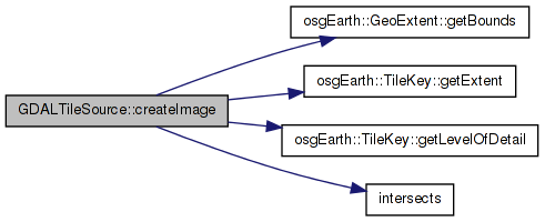
Here is the call graph for this function:| osg::Image* GDALTileSource::createImage | ( | const TileKey & | key, |
| ProgressCallback * | progress | ||
| ) | [inline, virtual] |
Creates an image for the given TileKey. The returned object is new and is the responsibility of the caller.
Implements osgEarth::TileSource.
Definition at line 1019 of file ReaderWriterGDAL.cpp.
    {
        if (key.getLevelOfDetail() > _maxDataLevel)
        {
            OE_DEBUG << LC << "" << getName() << ": Reached maximum data resolution key="
                << key.getLevelOfDetail() << " max=" << _maxDataLevel <<  std::endl;
            return NULL;
        }

        GDAL_SCOPED_LOCK;

        int tileSize = _options.tileSize().value();

        osg::ref_ptr<osg::Image> image;
        if (intersects(key)) //TODO: I think this test is OBE -gw
        {
            //Get the extents of the tile
            double xmin, ymin, xmax, ymax;
            key.getExtent().getBounds(xmin, ymin, xmax, ymax);

            double dx       = (xmax - xmin) / (tileSize-1);
            double dy       = (ymax - ymin) / (tileSize-1);


            int target_width = tileSize;
            int target_height = tileSize;
            int tile_offset_left = 0;
            int tile_offset_top = 0;

            int off_x = int((xmin - _geotransform[0]) / _geotransform[1]);
            int off_y = int((ymax - _geotransform[3]) / _geotransform[5]);
            int width = int(((xmax - _geotransform[0]) / _geotransform[1]) - off_x);
            int height = int(((ymin - _geotransform[3]) / _geotransform[5]) - off_y);

            if (off_x + width > _warpedDS->GetRasterXSize())
            {
                int oversize_right = off_x + width - _warpedDS->GetRasterXSize();
                target_width = target_width - int(float(oversize_right) / width * target_width);
                width = _warpedDS->GetRasterXSize() - off_x;
            }

            if (off_x < 0)
            {
                int oversize_left = -off_x;
                tile_offset_left = int(float(oversize_left) / width * target_width);
                target_width = target_width - int(float(oversize_left) / width * target_width);
                width = width + off_x;
                off_x = 0;
            }

            if (off_y + height > _warpedDS->GetRasterYSize())
            {
                int oversize_bottom = off_y + height - _warpedDS->GetRasterYSize();
                target_height = target_height - (int)osg::round(float(oversize_bottom) / height * target_height);
                height = _warpedDS->GetRasterYSize() - off_y;
            }


            if (off_y < 0)
            {
                int oversize_top = -off_y;
                tile_offset_top = int(float(oversize_top) / height * target_height);
                target_height = target_height - int(float(oversize_top) / height * target_height);
                height = height + off_y;
                off_y = 0;
            }

            OE_DEBUG << LC << "ReadWindow " << width << "x" << height << " DestWindow " << target_width << "x" << target_height << std::endl;

            //Return if parameters are out of range.
            if (width <= 0 || height <= 0 || target_width <= 0 || target_height <= 0)
            {
                return 0;
            }


            GDALRasterBand* bandRed = findBand(_warpedDS, GCI_RedBand);
            GDALRasterBand* bandGreen = findBand(_warpedDS, GCI_GreenBand);
            GDALRasterBand* bandBlue = findBand(_warpedDS, GCI_BlueBand);
            GDALRasterBand* bandAlpha = findBand(_warpedDS, GCI_AlphaBand);

            GDALRasterBand* bandGray = findBand(_warpedDS, GCI_GrayIndex);

                        GDALRasterBand* bandPalette = findBand(_warpedDS, GCI_PaletteIndex);

            //The pixel format is always RGBA to support transparency
            GLenum pixelFormat = GL_RGBA;


            if (bandRed && bandGreen && bandBlue)
            {
                unsigned char *red = new unsigned char[target_width * target_height];
                unsigned char *green = new unsigned char[target_width * target_height];
                unsigned char *blue = new unsigned char[target_width * target_height];
                unsigned char *alpha = new unsigned char[target_width * target_height];

                //Initialize the alpha values to 255.
                memset(alpha, 255, target_width * target_height);

                image = new osg::Image;
                image->allocateImage(tileSize, tileSize, 1, pixelFormat, GL_UNSIGNED_BYTE);
                memset(image->data(), 0, image->getImageSizeInBytes());

                //Nearest interpolation just uses RasterIO to sample the imagery and should be very fast.
                if (!*_options.interpolateImagery() || _options.interpolation() == INTERP_NEAREST)
                {
                    bandRed->RasterIO(GF_Read, off_x, off_y, width, height, red, target_width, target_height, GDT_Byte, 0, 0);
                    bandGreen->RasterIO(GF_Read, off_x, off_y, width, height, green, target_width, target_height, GDT_Byte, 0, 0);
                    bandBlue->RasterIO(GF_Read, off_x, off_y, width, height, blue, target_width, target_height, GDT_Byte, 0, 0);

                    if (bandAlpha)
                    {
                        bandAlpha->RasterIO(GF_Read, off_x, off_y, width, height, alpha, target_width, target_height, GDT_Byte, 0, 0);
                    }

                    for (int src_row = 0, dst_row = tile_offset_top;
                        src_row < target_height;
                        src_row++, dst_row++)
                    {
                        for (int src_col = 0, dst_col = tile_offset_left;
                            src_col < target_width;
                            ++src_col, ++dst_col)
                        {
                            *(image->data(dst_col, dst_row) + 0) = red[src_col + src_row * target_width];
                            *(image->data(dst_col, dst_row) + 1) = green[src_col + src_row * target_width];
                            *(image->data(dst_col, dst_row) + 2) = blue[src_col + src_row * target_width];
                            *(image->data(dst_col, dst_row) + 3) = alpha[src_col + src_row * target_width];
                        }
                    }

                    image->flipVertical();
                }
                else
                {
                    //Sample each point exactly
                    for (unsigned int c = 0; c < tileSize; ++c)
                    {
                        double geoX = xmin + (dx * (double)c);
                        for (unsigned int r = 0; r < tileSize; ++r)
                        {
                            double geoY = ymin + (dy * (double)r);
                            *(image->data(c,r) + 0) = getInterpolatedValue(bandRed,  geoX,geoY,false);
                            *(image->data(c,r) + 1) = getInterpolatedValue(bandGreen,geoX,geoY,false);
                            *(image->data(c,r) + 2) = getInterpolatedValue(bandBlue, geoX,geoY,false);
                            if (bandAlpha != NULL)
                                *(image->data(c,r) + 3) = getInterpolatedValue(bandAlpha,geoX, geoY, false);
                            else
                                *(image->data(c,r) + 3) = 255;
                        }
                    }
                }

                delete []red;
                delete []green;
                delete []blue;
                delete []alpha;
            }
            else if (bandGray)
            {
                unsigned char *gray = new unsigned char[target_width * target_height];
                unsigned char *alpha = new unsigned char[target_width * target_height];

                //Initialize the alpha values to 255.
                memset(alpha, 255, target_width * target_height);

                image = new osg::Image;
                image->allocateImage(tileSize, tileSize, 1, pixelFormat, GL_UNSIGNED_BYTE);
                memset(image->data(), 0, image->getImageSizeInBytes());


                if (!*_options.interpolateImagery() || _options.interpolation() == INTERP_NEAREST)
                {
                    bandGray->RasterIO(GF_Read, off_x, off_y, width, height, gray, target_width, target_height, GDT_Byte, 0, 0);

                    if (bandAlpha)
                    {
                        bandAlpha->RasterIO(GF_Read, off_x, off_y, width, height, alpha, target_width, target_height, GDT_Byte, 0, 0);
                    }

                    for (int src_row = 0, dst_row = tile_offset_top;
                        src_row < target_height;
                        src_row++, dst_row++)
                    {
                        for (int src_col = 0, dst_col = tile_offset_left;
                            src_col < target_width;
                            ++src_col, ++dst_col)
                        {
                            *(image->data(dst_col, dst_row) + 0) = gray[src_col + src_row * target_width];
                            *(image->data(dst_col, dst_row) + 1) = gray[src_col + src_row * target_width];
                            *(image->data(dst_col, dst_row) + 2) = gray[src_col + src_row * target_width];
                            *(image->data(dst_col, dst_row) + 3) = alpha[src_col + src_row * target_width];
                        }
                    }

                    image->flipVertical();
                }
                else
                {
                    for (int c = 0; c < tileSize; ++c)
                    {
                        double geoX = xmin + (dx * (double)c);

                        for (int r = 0; r < tileSize; ++r)
                        {
                            double geoY   = ymin + (dy * (double)r);
                            float  color = getInterpolatedValue(bandGray,geoX,geoY,false);

                            *(image->data(c,r) + 0) = color;
                            *(image->data(c,r) + 1) = color;
                            *(image->data(c,r) + 2) = color;
                            if (bandAlpha != NULL)
                                *(image->data(c,r) + 3) = getInterpolatedValue(bandAlpha,geoX,geoY,false);
                            else
                                *(image->data(c,r) + 3) = 255;
                        }
                    }
                }

                delete []gray;
                delete []alpha;

            }
                        else if (bandPalette)
            {
                //Pallete indexed imagery doesn't support interpolation currently and only uses nearest
                //b/c interpolating pallete indexes doesn't make sense.
                                unsigned char *palette = new unsigned char[target_width * target_height];

                image = new osg::Image;
                image->allocateImage(tileSize, tileSize, 1, pixelFormat, GL_UNSIGNED_BYTE);
                memset(image->data(), 0, image->getImageSizeInBytes());

                                bandPalette->RasterIO(GF_Read, off_x, off_y, width, height, palette, target_width, target_height, GDT_Byte, 0, 0);

                                for (int src_row = 0, dst_row = tile_offset_top;
                                        src_row < target_height;
                                        src_row++, dst_row++)
                                {
                                        for (int src_col = 0, dst_col = tile_offset_left;
                                                src_col < target_width;
                                                ++src_col, ++dst_col)
                                        {
                        osg::Vec4ub color;
                        getPalleteIndexColor( bandPalette, palette[src_col + src_row * target_width], color );

                        *(image->data(dst_col, dst_row) + 0) = color.r();
                        *(image->data(dst_col, dst_row) + 1) = color.g();
                        *(image->data(dst_col, dst_row) + 2) = color.b();
                        *(image->data(dst_col, dst_row) + 3) = color.a();
                                        }
                                }

                                image->flipVertical();

                                delete [] palette;

            }
            else
            {
                OE_WARN
                    << LC << "Could not find red, green and blue bands or gray bands in "
                    << _options.url()->full()
                    << ".  Cannot create image. " << std::endl;

                return NULL;
            }
        }

        // Moved this logic up into ImageLayer::createImageWrapper.
        //if (!image.valid())
        //{
        //    //OE_WARN << LC << "Illegal state-- should not get here" << std::endl;
        //    return ImageUtils::createEmptyImage();
        //}
        return image.release();
    }
Here is the call graph for this function:| static GDALRasterBand* GDALTileSource::findBand | ( | GDALDataset * | ds, |
| GDALColorInterp | colorInterp | ||
| ) | [inline, static] |
Finds a raster band based on color interpretation
Definition at line 924 of file ReaderWriterGDAL.cpp.
    {
        GDAL_SCOPED_LOCK;

        for (int i = 1; i <= ds->GetRasterCount(); ++i)
        {
            if (ds->GetRasterBand(i)->GetColorInterpretation() == colorInterp) return ds->GetRasterBand(i);
        }
        return 0;
    }
| float GDALTileSource::getInterpolatedValue | ( | GDALRasterBand * | band, |
| double | x, | ||
| double | y, | ||
| bool | applyOffset = true |
||
| ) | [inline] |
Definition at line 1328 of file ReaderWriterGDAL.cpp.
    {
        double r, c;
        GDALApplyGeoTransform(_invtransform, x, y, &c, &r);

        //Account for slight rounding errors.  If we are right on the edge of the dataset, clamp to the edge
        double eps = 0.0001;
        if (osg::equivalent(c, 0, eps)) c = 0;
        if (osg::equivalent(r, 0, eps)) r = 0;
        if (osg::equivalent(c, (double)_warpedDS->GetRasterXSize(), eps)) c = _warpedDS->GetRasterXSize();
        if (osg::equivalent(r, (double)_warpedDS->GetRasterYSize(), eps)) r = _warpedDS->GetRasterYSize();

        if (applyOffset)
        {
            //Apply half pixel offset
            r-= 0.5;
            c-= 0.5;

            //Account for the half pixel offset in the geotransform.  If the pixel value is -0.5 we are still technically in the dataset
            //since 0,0 is now the center of the pixel.  So, if are within a half pixel above or a half pixel below the dataset just use
            //the edge values
            if (c < 0 && c >= -0.5)
            {
                c = 0;
            }
            else if (c > _warpedDS->GetRasterXSize()-1 && c <= _warpedDS->GetRasterXSize()-0.5)
            {
                c = _warpedDS->GetRasterXSize()-1;
            }

            if (r < 0 && r >= -0.5)
            {
                r = 0;
            }
            else if (r > _warpedDS->GetRasterYSize()-1 && r <= _warpedDS->GetRasterYSize()-0.5)
            {
                r = _warpedDS->GetRasterYSize()-1;
            }
        }

        float result = 0.0f;

        //If the location is outside of the pixel values of the dataset, just return 0
        if (c < 0 || r < 0 || c > _warpedDS->GetRasterXSize()-1 || r > _warpedDS->GetRasterYSize()-1)
            return NO_DATA_VALUE;

        if ( _options.interpolation() == INTERP_NEAREST )
        {
            band->RasterIO(GF_Read, (int)osg::round(c), (int)osg::round(r), 1, 1, &result, 1, 1, GDT_Float32, 0, 0);
            if (!isValidValue( result, band))
            {
                return NO_DATA_VALUE;
            }
        }
        else
        {
            int rowMin = osg::maximum((int)floor(r), 0);
            int rowMax = osg::maximum(osg::minimum((int)ceil(r), (int)(_warpedDS->GetRasterYSize()-1)), 0);
            int colMin = osg::maximum((int)floor(c), 0);
            int colMax = osg::maximum(osg::minimum((int)ceil(c), (int)(_warpedDS->GetRasterXSize()-1)), 0);

            if (rowMin > rowMax) rowMin = rowMax;
            if (colMin > colMax) colMin = colMax;

            float urHeight, llHeight, ulHeight, lrHeight;

            band->RasterIO(GF_Read, colMin, rowMin, 1, 1, &llHeight, 1, 1, GDT_Float32, 0, 0);
            band->RasterIO(GF_Read, colMin, rowMax, 1, 1, &ulHeight, 1, 1, GDT_Float32, 0, 0);
            band->RasterIO(GF_Read, colMax, rowMin, 1, 1, &lrHeight, 1, 1, GDT_Float32, 0, 0);
            band->RasterIO(GF_Read, colMax, rowMax, 1, 1, &urHeight, 1, 1, GDT_Float32, 0, 0);

            /*
            if (!isValidValue(urHeight, band)) urHeight = 0.0f;
            if (!isValidValue(llHeight, band)) llHeight = 0.0f;
            if (!isValidValue(ulHeight, band)) ulHeight = 0.0f;
            if (!isValidValue(lrHeight, band)) lrHeight = 0.0f;
            */
            if (!isValidValue(urHeight, band) || (!isValidValue(llHeight, band)) ||(!isValidValue(ulHeight, band)) || (!isValidValue(lrHeight, band)))
            {
                return NO_DATA_VALUE;
            }

            if ( _options.interpolation() == INTERP_AVERAGE )
            {
                double x_rem = c - (int)c;
                double y_rem = r - (int)r;

                double w00 = (1.0 - y_rem) * (1.0 - x_rem) * (double)llHeight;
                double w01 = (1.0 - y_rem) * x_rem * (double)lrHeight;
                double w10 = y_rem * (1.0 - x_rem) * (double)ulHeight;
                double w11 = y_rem * x_rem * (double)urHeight;

                result = (float)(w00 + w01 + w10 + w11);
            }
            else if ( _options.interpolation() == INTERP_BILINEAR )
            {
                //Check for exact value
                if ((colMax == colMin) && (rowMax == rowMin))
                {
                    //OE_NOTICE << "Exact value" << std::endl;
                    result = llHeight;
                }
                else if (colMax == colMin)
                {
                    //OE_NOTICE << "Vertically" << std::endl;
                    //Linear interpolate vertically
                    result = ((float)rowMax - r) * llHeight + (r - (float)rowMin) * ulHeight;
                }
                else if (rowMax == rowMin)
                {
                    //OE_NOTICE << "Horizontally" << std::endl;
                    //Linear interpolate horizontally
                    result = ((float)colMax - c) * llHeight + (c - (float)colMin) * lrHeight;
                }
                else
                {
                    //OE_NOTICE << "Bilinear" << std::endl;
                    //Bilinear interpolate
                    float r1 = ((float)colMax - c) * llHeight + (c - (float)colMin) * lrHeight;
                    float r2 = ((float)colMax - c) * ulHeight + (c - (float)colMin) * urHeight;

                    //OE_INFO << "r1, r2 = " << r1 << " , " << r2 << std::endl;
                    result = ((float)rowMax - r) * r1 + (r - (float)rowMin) * r2;
                }
            }
        }

        return result;
    }
| static void GDALTileSource::getPalleteIndexColor | ( | GDALRasterBand * | band, |
| int | index, | ||
| osg::Vec4ub & | color | ||
| ) | [inline, static] |
Definition at line 935 of file ReaderWriterGDAL.cpp.
    {
        const GDALColorEntry *colorEntry = band->GetColorTable()->GetColorEntry( index );
        GDALPaletteInterp interp = band->GetColorTable()->GetPaletteInterpretation();
        if (!colorEntry)
        {
            //FIXME: What to do here?

            //OE_INFO << "NO COLOR ENTRY FOR COLOR " << rawImageData[i] << std::endl;
            color.r() = 255;
            color.g() = 0;
            color.b() = 0;
            color.a() = 1;

        }
        else
        {
            if (interp == GPI_RGB)
            {
                color.r() = colorEntry->c1;
                color.g() = colorEntry->c2;
                color.b() = colorEntry->c3;
                color.a() = colorEntry->c4;
            }
            else if (interp == GPI_CMYK)
            {
                // from wikipedia.org
                short C = colorEntry->c1;
                short M = colorEntry->c2;
                short Y = colorEntry->c3;
                short K = colorEntry->c4;
                color.r() = 255 - C*(255 - K) - K;
                color.g() = 255 - M*(255 - K) - K;
                color.b() = 255 - Y*(255 - K) - K;
                color.a() = 255;
            }
            else if (interp == GPI_HLS)
            {
                // from easyrgb.com
                float H = colorEntry->c1;
                float S = colorEntry->c3;
                float L = colorEntry->c2;
                float R, G, B;
                if ( S == 0 )                       //HSL values = 0 - 1
                {
                    R = L;                      //RGB results = 0 - 1
                    G = L;
                    B = L;
                }
                else
                {
                    float var_2, var_1;
                    if ( L < 0.5 )
                        var_2 = L * ( 1 + S );
                    else
                        var_2 = ( L + S ) - ( S * L );

                    var_1 = 2 * L - var_2;

                    R = Hue_2_RGB( var_1, var_2, H + ( 1 / 3 ) );
                    G = Hue_2_RGB( var_1, var_2, H );
                    B = Hue_2_RGB( var_1, var_2, H - ( 1 / 3 ) );
                }
                color.r() = static_cast<unsigned char>(R*255.0f);
                color.g() = static_cast<unsigned char>(G*255.0f);
                color.b() = static_cast<unsigned char>(B*255.0f);
                color.a() = static_cast<unsigned char>(255.0f);
            }
            else if (interp == GPI_Gray)
            {
                color.r() = static_cast<unsigned char>(colorEntry->c1*255.0f);
                color.g() = static_cast<unsigned char>(colorEntry->c1*255.0f);
                color.b() = static_cast<unsigned char>(colorEntry->c1*255.0f);
                color.a() = static_cast<unsigned char>(255.0f);
            }
        }
    }
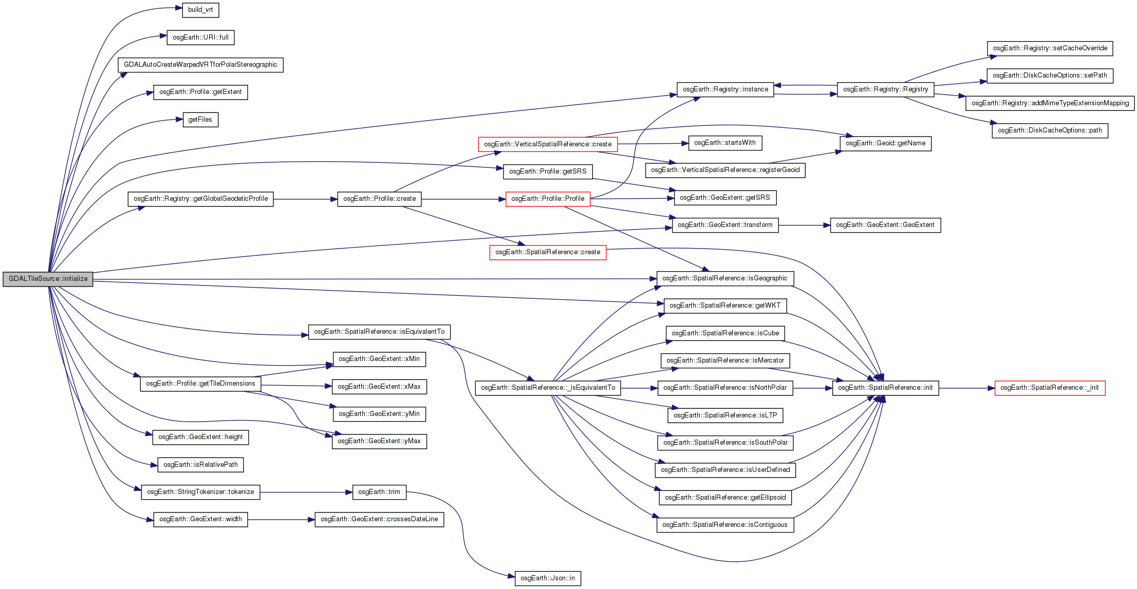
Here is the call graph for this function:| void GDALTileSource::initialize | ( | const std::string & | referenceURI, |
| const Profile * | overrideProfile | ||
| ) | [inline, virtual] |
Initialize the TileSource. The profile should be computed and set here using setProfile()
Implements osgEarth::TileSource.
Definition at line 640 of file ReaderWriterGDAL.cpp.
    {
        GDAL_SCOPED_LOCK;

        if ( !_options.url().isSet() || _options.url()->empty() )
        {
            OE_WARN << LC << "No URL or directory specified " << std::endl;
            return;
        }

        URI uri = _options.url().value();

        //Find the full path to the URL
        //If we have a relative path and the map file contains a server address, just concat the server path and the _url together

        if (osgEarth::isRelativePath(uri.full()) && osgDB::containsServerAddress(referenceURI))
        {
            uri = URI(osgDB::getFilePath(referenceURI) + std::string("/") + uri.full());
        }

        //If the path doesn't contain a server address, get the full path to the file.
        if (!osgDB::containsServerAddress(uri.full()))
        {
            uri = URI(uri.full(), referenceURI);
        }

        StringTokenizer izer( ";" );
        StringVector exts;
        izer.tokenize( *_options.extensions(), exts );

        //std::vector<std::string> exts;

        //tokenize( _options.extensions().value(), exts, ";");
        for (unsigned int i = 0; i < exts.size(); ++i)
        {
            OE_DEBUG << LC << "Using Extension: " << exts[i] << std::endl;
        }
        std::vector<std::string> files;
        getFiles(uri.full(), exts, files);

        OE_INFO << LC << "Driver found " << files.size() << " files:" << std::endl;
        for (unsigned int i = 0; i < files.size(); ++i)
        {
            OE_INFO << LC << "" << files[i] << std::endl;
        }

        if (files.empty())
        {
            OE_WARN << LC << "Could not find any valid files " << std::endl;
            return;
        }

        //If we found more than one file, try to combine them into a single logical dataset
        if (files.size() > 1)
        {
            _srcDS = (GDALDataset*)build_vrt(files, HIGHEST_RESOLUTION);
            if (!_srcDS)
            {
                OE_WARN << "[osgEarth::GDAL] Failed to build VRT from input datasets" << std::endl;
                return;
            }
        }
        else
        {
            //If we couldn't build a VRT, just try opening the file directly
            //Open the dataset
            _srcDS = (GDALDataset*)GDALOpen( files[0].c_str(), GA_ReadOnly );
            if ( !_srcDS )
            {
                OE_WARN << LC << "Failed to open dataset " << files[0] << std::endl;
                return;
            }
        }

        //Create a spatial reference for the source.
        const char* srcProj = _srcDS->GetProjectionRef();
        if ( srcProj != 0L && overrideProfile != 0L )
        {
            OE_WARN << LC << "WARNING, overriding profile of a source that already defines its own SRS ("
                << this->getName() << ")" << std::endl;
        }

        osg::ref_ptr<const SpatialReference> src_srs;
        if ( overrideProfile )
        {
            src_srs = overrideProfile->getSRS();
        }
        else if ( srcProj )
        {
            src_srs = SpatialReference::create( srcProj );
        }

        // assert SRS is present
        if ( !src_srs.valid() )
        {
            // not found in the dataset; try loading a .prj file
            std::string prjLocation = osgDB::getNameLessExtension( uri.full() ) + std::string(".prj");
            std::string wkt;
            if ( HTTPClient::readString( prjLocation, wkt ) == HTTPClient::RESULT_OK )
            {
                src_srs = SpatialReference::create( wkt );
            }

            if ( !src_srs.valid() )
            {
                OE_WARN << LC << "Dataset has no spatial reference information: " << uri.full() << std::endl;
                return;
            }
        }

        const Profile* profile = NULL;

        if ( overrideProfile )
        {
            profile = overrideProfile;
        }

        if ( !profile && src_srs->isGeographic() )
        {
            profile = osgEarth::Registry::instance()->getGlobalGeodeticProfile();
        }

        //Note:  Can cause odd rendering artifacts if we have a dataset that is mercator that doesn't encompass the whole globe
        //       if we take on the global profile.
        /*
        if ( !profile && src_srs->isMercator() )
        {
            profile = osgEarth::Registry::instance()->getGlobalMercatorProfile();
        }*/

        std::string warpedSRSWKT;

        if ( profile && !profile->getSRS()->isEquivalentTo( src_srs.get() ) )
        {
            if ( profile->getSRS()->isGeographic() && (src_srs->isNorthPolar() || src_srs->isSouthPolar()) )
            {
                _warpedDS = (GDALDataset*)GDALAutoCreateWarpedVRTforPolarStereographic(
                    _srcDS,
                    src_srs->getWKT().c_str(),
                    profile->getSRS()->getWKT().c_str(),
                    GRA_NearestNeighbour,
                    5.0,
                    NULL);
            }
            else
            {
                _warpedDS = (GDALDataset*)GDALAutoCreateWarpedVRT(
                    _srcDS,
                    src_srs->getWKT().c_str(),
                    profile->getSRS()->getWKT().c_str(),
                    GRA_NearestNeighbour,
                    5.0,
                    NULL);
            }

            if ( _warpedDS )
            {
                warpedSRSWKT = _warpedDS->GetProjectionRef();
            }

            //GDALAutoCreateWarpedVRT(srcDS, src_wkt.c_str(), t_srs.c_str(), GRA_NearestNeighbour, 5.0, NULL);
        }
        else
        {
            _warpedDS = _srcDS;
            warpedSRSWKT = src_srs->getWKT();
        }

        //Get the _geotransform
        if (overrideProfile)
        {
            _geotransform[0] = overrideProfile->getExtent().xMin(); //Top left x
            _geotransform[1] = overrideProfile->getExtent().width() / (double)_warpedDS->GetRasterXSize();//pixel width
            _geotransform[2] = 0;

            _geotransform[3] = overrideProfile->getExtent().yMax(); //Top left y
            _geotransform[4] = 0;
            _geotransform[5] = -overrideProfile->getExtent().height() / (double)_warpedDS->GetRasterYSize();//pixel height

        }
        else
        {
            _warpedDS->GetGeoTransform(_geotransform);
        }

        GDALInvGeoTransform(_geotransform, _invtransform);


        //Compute the extents
        // polar needs a special case when combined with geographic
        if ( profile && profile->getSRS()->isGeographic() && (src_srs->isNorthPolar() || src_srs->isSouthPolar()) )
        {
            double ll_lon, ll_lat, ul_lon, ul_lat, ur_lon, ur_lat, lr_lon, lr_lat;

            pixelToGeo(0.0, 0.0, ul_lon, ul_lat );
            pixelToGeo(0.0, _warpedDS->GetRasterYSize(), ll_lon, ll_lat);
            pixelToGeo(_warpedDS->GetRasterXSize(), _warpedDS->GetRasterYSize(), lr_lon, lr_lat);
            pixelToGeo(_warpedDS->GetRasterXSize(), 0.0, ur_lon, ur_lat);

            _extentsMin.x() = osg::minimum( ll_lon, osg::minimum( ul_lon, osg::minimum( ur_lon, lr_lon ) ) );
            _extentsMax.x() = osg::maximum( ll_lon, osg::maximum( ul_lon, osg::maximum( ur_lon, lr_lon ) ) );

            if ( src_srs->isNorthPolar() )
            {
                _extentsMin.y() = osg::minimum( ll_lat, osg::minimum( ul_lat, osg::minimum( ur_lat, lr_lat ) ) );
                _extentsMax.y() = 90.0;
            }
            else
            {
                _extentsMin.y() = -90.0;
                _extentsMax.y() = osg::maximum( ll_lat, osg::maximum( ul_lat, osg::maximum( ur_lat, lr_lat ) ) );
            }
        }
        else
        {
            pixelToGeo(0.0, _warpedDS->GetRasterYSize(), _extentsMin.x(), _extentsMin.y());
            pixelToGeo(_warpedDS->GetRasterXSize(), 0.0, _extentsMax.x(), _extentsMax.y());
        }

        OE_INFO << LC << "Geo extents: " << _extentsMin.x() << ", " << _extentsMin.y() << " => " << _extentsMax.x() << ", " << _extentsMax.y() << std::endl;

        if ( !profile )
        {
            profile = Profile::create(
                warpedSRSWKT,
                //_warpedDS->GetProjectionRef(),
                _extentsMin.x(), _extentsMin.y(), _extentsMax.x(), _extentsMax.y() );

            OE_INFO << LC << "" << uri.full() << " is projected, SRS = "
                << warpedSRSWKT << std::endl;
                //<< _warpedDS->GetProjectionRef() << std::endl;
        }

        //Compute the min and max data levels
        double resolutionX = (_extentsMax.x() - _extentsMin.x()) / (double)_warpedDS->GetRasterXSize();
        double resolutionY = (_extentsMax.y() - _extentsMin.y()) / (double)_warpedDS->GetRasterYSize();

                double maxResolution = osg::minimum(resolutionX, resolutionY);

        OE_INFO << LC << "Resolution= " << resolutionX << "x" << resolutionY << " max=" << maxResolution << std::endl;

        if (_options.maxDataLevel().isSet())
        {
            _maxDataLevel = _options.maxDataLevel().value();
            OE_INFO << "Using override max data level " << _maxDataLevel << std::endl;
        }
        else
        {
            unsigned int max_level = 30;
            for (unsigned int i = 0; i < max_level; ++i)
            {
                _maxDataLevel = i;
                double w, h;
                profile->getTileDimensions(i, w, h);
                double resX = (w / (double)_options.tileSize().value() );
                double resY = (h / (double)_options.tileSize().value() );

                if (resX < maxResolution || resY < maxResolution)
                {
                    break;
                }
            }

            OE_INFO << LC << "Max Data Level: " << _maxDataLevel << std::endl;
        }

        // record the data extent in profile space:
        GeoExtent local_extent(
            SpatialReference::create( warpedSRSWKT ), //_warpedDS->GetProjectionRef() ),
            _extentsMin.x(), _extentsMin.y(), _extentsMax.x(), _extentsMax.y() );
        GeoExtent profile_extent = local_extent.transform( profile->getSRS() );

        getDataExtents().push_back( DataExtent(profile_extent, 0, _maxDataLevel) );

        OE_INFO << LC << "Data Extents: " << profile_extent.toString() << std::endl;

                //Set the profile
                setProfile( profile );
    }
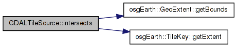
Here is the call graph for this function:| bool GDALTileSource::intersects | ( | const TileKey & | key | ) | [inline] |
Definition at line 1506 of file ReaderWriterGDAL.cpp.
    {
        //Get the native extents of the tile
        double xmin, ymin, xmax, ymax;
        key.getExtent().getBounds(xmin, ymin, xmax, ymax);

        return ! ( xmin >= _extentsMax.x() || xmax <= _extentsMin.x() || ymin >= _extentsMax.y() || ymax <= _extentsMin.y() );
    }
Here is the call graph for this function:| bool GDALTileSource::isValidValue | ( | float | v, |
| GDALRasterBand * | band | ||
| ) | [inline] |
Definition at line 1299 of file ReaderWriterGDAL.cpp.
    {
        GDAL_SCOPED_LOCK;

        float bandNoData = -32767.0f;
        int success;
        float value = band->GetNoDataValue(&success);
        if (success)
        {
            bandNoData = value;
        }

        //Check to see if the value is equal to the bands specified no data
        if (bandNoData == v) return false;
        //Check to see if the value is equal to the user specified nodata value
        if (getNoDataValue() == v) return false;

        //Check to see if the user specified a custom min/max
        if (v < getNoDataMinValue()) return false;
        if (v > getNoDataMaxValue()) return false;

        //Check within a sensible range
        if (v < -32000) return false;
        if (v > 32000) return false;

        return true;
    }
| void GDALTileSource::pixelToGeo | ( | double | x, |
| double | y, | ||
| double & | geoX, | ||
| double & | geoY | ||
| ) | [inline] |
Definition at line 1013 of file ReaderWriterGDAL.cpp.
    {
        geoX = _geotransform[0] + _geotransform[1] * x + _geotransform[2] * y;
        geoY = _geotransform[3] + _geotransform[4] * x + _geotransform[5] * y;
    }
osg::Vec2d GDALTileSource::_extentsMax [private] |
Definition at line 1524 of file ReaderWriterGDAL.cpp.
osg::Vec2d GDALTileSource::_extentsMin [private] |
Definition at line 1523 of file ReaderWriterGDAL.cpp.
double GDALTileSource::_geotransform[6] [private] |
Definition at line 1520 of file ReaderWriterGDAL.cpp.
double GDALTileSource::_invtransform[6] [private] |
Definition at line 1521 of file ReaderWriterGDAL.cpp.
unsigned int GDALTileSource::_maxDataLevel [private] |
Definition at line 1534 of file ReaderWriterGDAL.cpp.
const GDALOptions GDALTileSource::_options [private] |
Reimplemented from osgEarth::TileSource.
Definition at line 1531 of file ReaderWriterGDAL.cpp.
GDALDataset* GDALTileSource::_srcDS [private] |
Definition at line 1518 of file ReaderWriterGDAL.cpp.
GDALDataset* GDALTileSource::_warpedDS [private] |
Definition at line 1519 of file ReaderWriterGDAL.cpp.
 1.7.3
1.7.3